Kuala Lumpur (KL) old map
You can find on this page the Kuala Lumpur (KL) old map to print and to download in PDF. The Kuala Lumpur (KL) historical map and the vintage map of Kuala Lumpur (KL) present the past and evolutions of the city of Kuala Lumpur (KL) in Malaysia.
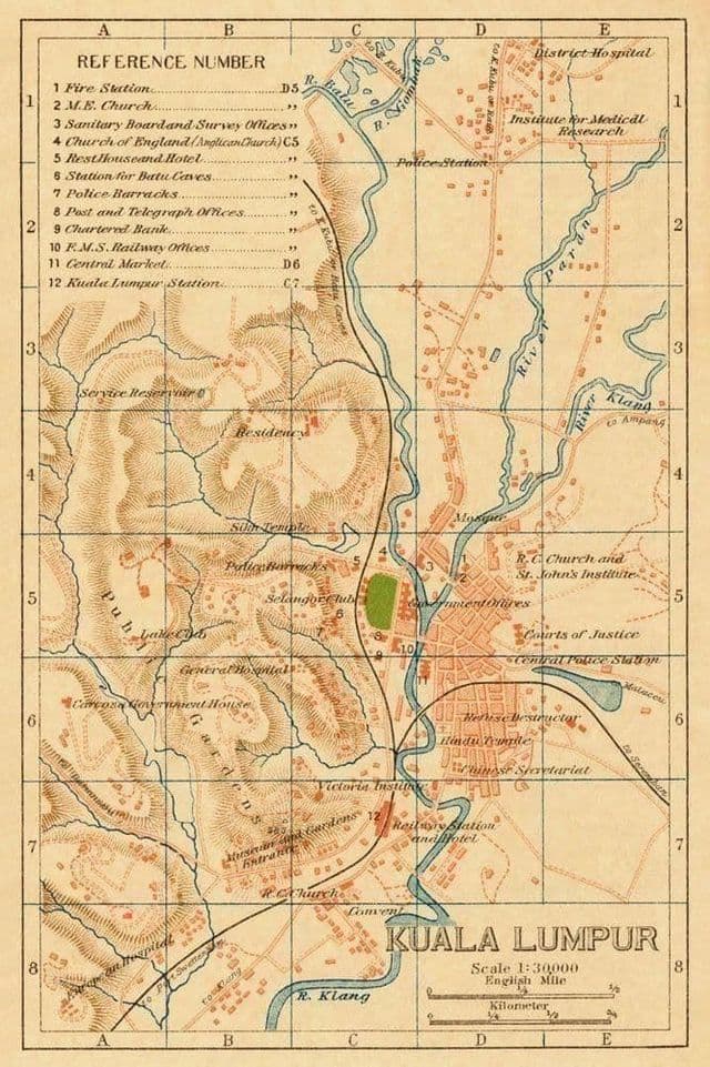
Kuala Lumpur (KL) historical map
The Kuala Lumpur (KL) old map shows evolutions of Kuala Lumpur (KL) city. This historical map of Kuala Lumpur (KL) will allow you to travel in the past and in the history of Kuala Lumpur (KL) in Malaysia. The Kuala Lumpur (KL) ancient map is downloadable in PDF, printable and free.
The miners landed at the confluence of Sungai Gombak (previously known as Sungai Lumpur, meaning “muddy river”) and Sungai Klang (Klang River) to open mines at Ampang, Pudu and Batu as you can see in Kuala Lumpur (KL) historical map. These mines developed into a trading post which became a frontier town. The tin prospectors settled in Ampang, and formed gangs within themselves. The two largest Chinese gangsters, the Hakka-dominated Hai San and the Hokkien-dominated Ghee Hin, frequently engaged in warfare to gain control of tin production in the historical town of Kuala Lumpur (KL). The incessant warfare between the two factions brought tin mine production to a standstill, prompting the British, who ruled the Federation of Malaya at that time, to appoint a Chinese Kapitan (headman) to administer Kuala Lumpur (KL).