Kuala Lumpur (KL) airport map
You can find on this page the Kuala Lumpur (KL) airports map to print and to download in PDF. The Kuala Lumpur (KL) airport map presents terminals and gates of the international airport of Kuala Lumpur (KL) in Malaysia.
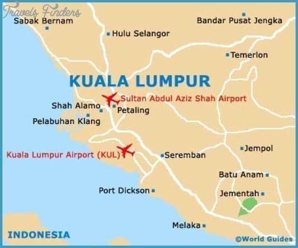
Kuala Lumpur (KL) airports map
The Kuala Lumpur (KL) airports map shows all the airports around Kuala Lumpur (KL). This airports map of Kuala Lumpur (KL) will allow you to determine which airport you will used to leave Kuala Lumpur (KL) in Malaysia. The Kuala Lumpur (KL) airports map is downloadable in PDF, printable and free.
Catering to a booming tourism industry, Kuala Lumpur (KL) airports are fitted with top-notch facilities, ample shopping and dining venues, spacious terminals, as well as quality accommodations situated within walking distances. Malaysia primary international aviation gateway, Kuala Lumpur International Airport (KLIA) in Sepang houses luxury lounges, a wide variety of restaurants, children’s play areas and duty-free stores as its mentioned in Kuala Lumpur (KL) airports map.
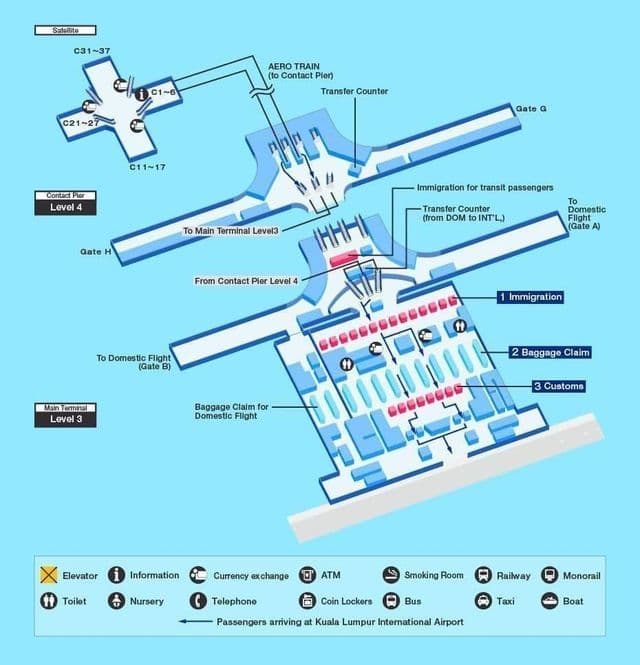
Kuala Lumpur (KL) international airport map
The map of Kuala Lumpur (KL) airport presents the main international airport of Kuala Lumpur (KL). This international airport map of Kuala Lumpur (KL) will allow you to determine by which terminal and gate you will arrive or leave Kuala Lumpur (KL) in Malaysia. The airport Kuala Lumpur (KL) map is downloadable in PDF, printable and free.
Kuala Lumpur International Airport (KLIA) (IATA: KUL, ICAO: WMKK) is Malaysia main international airport and is also one of the major airports of South East Asia, giving it huge, even multinational, catchment area. It is about 50 kilometres (31 mi) from Malaysia capital, Kuala Lumpur (KL). The airport is in the Sepang district of southern Selangor state as you can see in Kuala Lumpur (KL) international airport map. KLIA construction cost RM8.5 billion or US$3.5 billion. The airport can currently handle 35 million passengers and 1.2 million tonnes of cargo a year. In 2010, it handled 34,087,636 passengers; in 2008 it handled 667,495 metric tonnes of cargo. It was ranked the 18th busiest airport in the world by international passenger traffic, and is the 7th busiest international airport in Asia. It was ranked the 28th busiest airport by cargo traffic in 2009. The Bernama News Agency reported a modest growth in traffic in the first six months of 2011, with an almost 13% increase from 16.2 million to 18.3 million passengers.